
A project targeting biodiversity gain and climate change resilience in Bloomsbury, London is turning to data captured by Bluesky International’s National Tree Map to ensure proposals are built on evidence-based solutions
- Location: London, UK

- Client: Green Infrastructure Consultancy
- Completion: Ongoing
The Green Infrastructure Consultancy has been commissioned to provide a strategy for Wild Bloomsbury, a project aimed at increasing both the quantity and quality of multifunctional green infrastructure in Bloomsbury for the benefit of people and wildlife.
The Green Infrastructure Consultancy is a UK-based company advising private, government, institutional and NGO clients on urban green infrastructure policy, strategy, planning, design, installation and maintenance.
National Tree Map is the most accurate tree map available
Data from Bluesky’s National Tree Map (NTM) was chosen to support the Green Infrastructure Consultancy report as it could provide evidence of existing green cover over the required area. The NTM is a unique dataset and is the most accurate tree map available covering all of England, Wales and the Republic of Ireland; Scotland will be coming online soon. It provides data of all tree canopy coverage and heights for trees 3m and taller and is updated and maintained on a rolling three-year update programme.
The NTM has been created using Bluesky’s high-quality, high-resolution aerial photography and height datasets coupled with innovative processing techniques. It can provide valuable data to numerous organisations for a variety of projects, but in recent months Bluesky has seen an increasing number of companies apply the NTM to climate change reduction initiatives.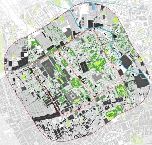
The Wild Bloomsbury project
The Wild Bloomsbury project, which the Green Infrastructure Consultancy is advising on, is one such initiative as it aims to help with climate change adaptation and mitigation and, importantly, will reverse biodiversity loss in the district. It is a partnership between University College London (UCL), University of London, Bedford Estates and the London Borough of Camden.
Gary Grant, a director at the Green Infrastructure Consultancy, authored the report. He said: “Having accurate data to present to our clients is important as it gives them the confidence to know they are making informed decisions. Bluesky’s National Tree Map is an important tool for us as we have found data provided from other sources can be quite patchy and does not give the full picture. The National Tree Map has not only been used at the start of this process, but it will be part of the ongoing monitoring of the site so we can analyse what has been achieved.
“Having tools and data to support our work is critical because it means we can be more targeted in our approach. Increasing green infrastructure in our urban areas is a priority as we fight against climate change. Well planned and implemented projects can bring many benefits including improved mental and physical health, reduced risk of flash flooding, summer cooling, better air and water quality, food and more biodiversity.”
Ralph Coleman, director of sales at Bluesky, added: “Wild Bloomsbury is one of the many urban greening initiatives underway as local authorities and commercial organisations look to focus their plans with clear targets to tackle climate change. This is why providing accurate data is so important, to evaluate projects and catalogue what assets currently exist to help maximise the efficacy of biodiversity initiatives.
Geospatial data as a benchmark
“Geospatial data is increasingly being used as a benchmarking tool illustrating the status quo, enabling the analysis of patterns of change over time to better inform decisions and plans. We are ahead of the game with the NTM offering, a unique digital map of tree canopy, which is updated on a rolling three-year update programme. This means tree canopy change can be assessed, monitored and analysed. Geospatial data should be sitting at the heart of government and business decision making and policy adoption, as it offers insight to mitigate risk.”
The NTM is created using innovative algorithms and image processing techniques in combination with the most up-to-date and detailed national aerial photography and height data. In addition to the three vector map layers – Crown Polygons, Idealised Crowns and Height Points – Bluesky’s NTM also includes an attribute table including unique identification for each crown feature, height attributes and area calculations.
The Green Infrastructure Consultancy has been commissioned to conduct a report setting out the strategy for the Wild Bloomsbury project with several recommended projects for implementation. Visit Green Infrastructure Consultancy – policy, planning, design and build to find out more about their work or visit National Tree Map | Bluesky International to learn more about the NTM.
Ralph Coleman
Director of sales
Tel: +44 (0)1530 518 518


