Cable Tracing Services Ltd.

Serving The Utilities Industry
Specialising In:
– C2/Plant Enquiry & Stat Packs
– Underground Utility Detection
– Utility Topo Surveys
– 2D & 3D CAD Design
– HDS 3D Laser Scanning
C2/Plant Enquiry & Stat Pack
The company can offer a C2/Plant enquiry to obtain drawings; preferably 6 weeks prior to excavation from the relevant statutory undertakers who have plant in the area of which the project is to be carried out. This service can extend to as many as 47 companies. Having as much information as this at the starting period of any project can be highly advantageous to the planning. This also aids the prevention of costs incurred to damaged apparatus which you could be unaware of without the information supplied within the enquiry. The enquiry is logged and reported to the client on completion along with a list of emergency numbers of the statutory undertakers. There is also a check carried out to identify High Pressure Gas Mains, Oil and Esso Pipelines. These are reported to the client prior to excavation to assist in the smooth running of the project.
CTS stat packs have been designed for ease of use, they are presented in PDF format with embedded clickable links, there is a key focus on providing clear and legible drawings.
The stat pack design enables the document to be used on modern day tablets, the links work on touch screens. The stat packs can also be supplied in an A3 bound (Fastback) pack.
2D & 3D CAD Design
CTS can provide 2D CAD services for projects ranging from Desktop Surveys, Topographical information, As-Builds & Planning design.
Our specialist has experience being office and site based for the past 30 years, working in the utilities industry.
Our attention to detail when collecting data in the field is essential to our cad design drawings, CTS designs and uses specially tailored feature code libraries to ensure the data collection process is accurate and complete.
We are constantly improving our data collection process and layer our information as per statutory undertakers which provides accurate infoametion to assist in the C2,C3 and C4 processes.
CTS can also offer 3D cad design drawings of underground pipe networks and street scapes.
Our drawings and designed in AutoCAD 2016 and can be imported in Revit for BIM modelling, our feature coding works in unison with the data collection process and import procedures, the block definitions contain all the attributes of the line styles and ensures accurate modelling.
From non-intrusive surveys to combined working with our clients on excavated areas the results are mm accurate and can also extend to designing new parts and assets which can be presented in the 3D cad model.
Undergorund Utility Detection
There is a growing need to avoid damage to buried utilities lines when digging. With this in mind CTS provides on-site mark-ups for underground utilities. RD8000s are used for the detection of underground utilities and the mark up indicates the various utilities with an easy to read key.
All underground utility detection is carried out by two man teams; this allows for health and safety conditions to be met and reduces the time taken to carry out the survey. On arrival the team will meet with the relevant personnel to identify the type of mark-up required. The team will then conduct their survey using RD8000 CAT and Genny’s to detect underground utilities. Unfortunately not all utilities can be identified with this equipment alone, therefore all teams carry Signal Clamps/Flexi-trace/Sondes/Mice to assist with the location of Fibre Optic cables and duct work. Once located, utilities are identified with paint using the following code:
- Electric: LV/HV/EHV and Street Lighting (RED)
- Gas: Mains and Services (YELLOW)
- Water: Mains and Services (BLUE)
- Cable TV and Fibre Cable (GREEN)
- Traffic Control Sensor Units and Miscellaneous (WHITE)
In order to provide you with as much information as possible not only are the utilities marked, where possible the sizes and configurations are also shown. On completion of the survey, the team will meet with the on-site personnel and walk through the job to discuss their findings.
Services Included
– Detection of Electric cables, Gas and Water mains
– Detection of Fibre Optic cable and duct work
– Onsite Mark Up
CTS is committed in offering our clients the service of ground penetrating radar surveys, using all of our years of experience in locating buried pipes and having the opportunity in working alongside open trenches in and around London in some of the most congested footpaths are carriage ways in the UK.
Our knowledge can be channelled into GPR surveys, The sytem CTS has incorporated comes from the world leaders in GPR knowledge & support, we have access to a wide range of antennas to suit the specific project.
The survey could be to find a specific non-metallic pipe with an onsite mark up, wall or floor investigations or any type of void, the information can be recorded and presented in an easy to read format.
Combining our full plant enquiries, intensive utility surveys using the RD8000 & the RD/TX10 the area can also be GPR surveyed to give the most comprehensive survey available.
The GPR survey is quick and can be carried out in any environment; we offer a night service to overcome the traffic in and around London.
For more information on GPR surveys or any other of our services please get in touch, we are here to answer all of your questions. Head Office 01277 822102
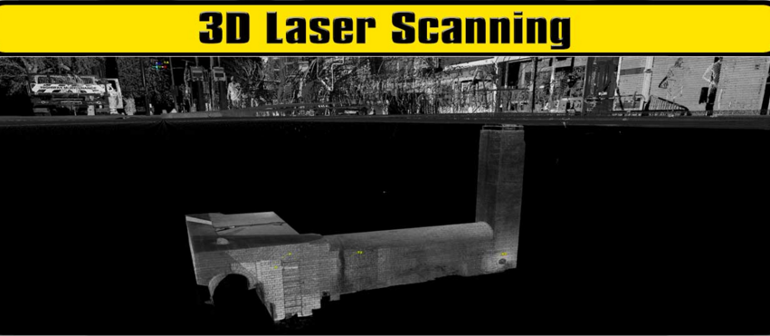
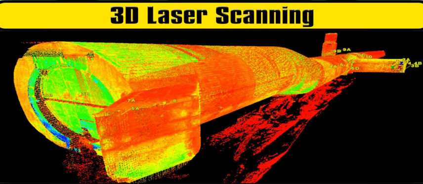
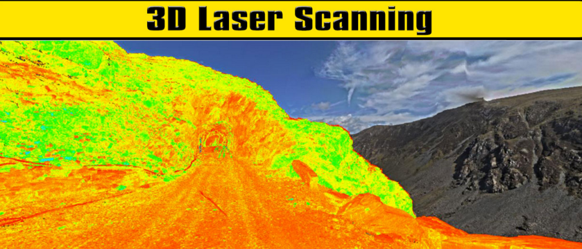
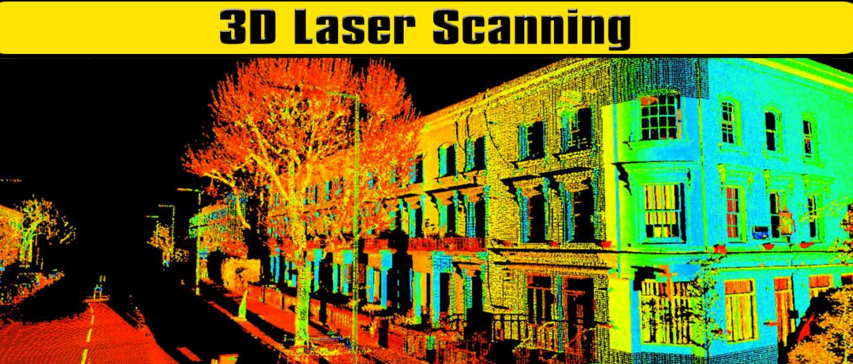
3D Laser Scanning
CTS are committed to offering 3D Laser Scanning surveys for Design and Monitoring. Using the latest technology to the market the results are truly amazing. Our surveyors years of experience and coordinated setting out procedures enhances the results. The surveys can be aligned to OS National Grid Datum and support is given for our clients in viewing the data. We can offer the full range of common point cloud data files and extend the service to allow for Truveiw out put. Combined with CTS utility surveys we can produce a full model of Street Scapes and Underground pipes. Our survey teams are also confined space trained for Tunnel surveys. Take a look at the below categories for more info or please contact joseph@ctsltd.info
Utility Topo Surveys
CTS can provide a comprehensive Topographical Survey using the latest in Trimble technology.
mm accurate data can be achieved throughout the UK. Every point collected has an X,Y & Z Measurement to OS National Grid Datum.
Specially tailored Attribute Libraries can show as much information as is required. Collecting all information in the field will alleviate the amount manipulating needed in the office. Joining lines, snapping on and colour coding can all be achieved before the data reaches the client. We not only supply the Raw Data but also the Data Bases and Spread Sheets of data either in Access or Excel.
Utility surveys can provide an extensive platform either in GIS or CAD formats, all the utilities captured on site will be colour coded and show the material, depth, and size, using this information is invaluable for your health and safety and planning needs.
Services Provided:
– Topographical Surveys
– Utility Topographical Surveys
– Feature& Attribute Libraries
– Setting Out