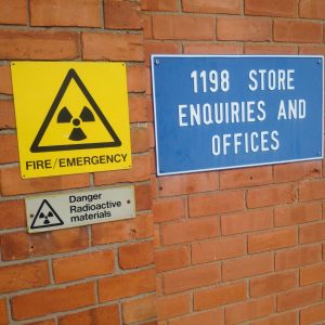
Paul Nathanail, managing director of specialist environmental consultancy Land Quality Management Ltd, reflects on the role of information in delivering on the recent Homes England – Ministry of Defence partnership goal of 10,000 homes
#tldr Successfully redeveloping surplus military land is helped by detailed desk studies overcoming limitations in normal information sources
The recent announcement of a partnership between Homes England (HE) and the Ministry of Defence (MoD) got me thinking. HE and the MoD’s Defence Infrastructure Organisation (DIO) will work together to deliver over 10,000 homes on 7 different parcels of surplus army land – with the potential for more such land in the future.
 Land that has been part of military bases since World War 1 in some cases is no longer needed as DIO modernises the defence estate. High time for former MOD land to serve its local residents and the economy in new ways.
Gathering the evidence to support a planning application for redeveloping former military land – like all brownfield land – begins with a desk study and a walkover survey. But many military sites were not marked on Ordnance Survey maps until relatively recently.
The former RAF Spitalgate, one of the 7 sites, opened in 1915. Yet the 1930s editions of the 1:10,560 scale OS maps show the site as open fields crossed by a bridleway and a Cold Harbour Lane (though not the one of Millwall Football Club fame). As late as the 1950s, the OS only partly revealed the true land use by overprinting “Airfield” on the fields and showing an abruptly truncated Cold Harbour Lane. By 1977, Spitalgate Airfield and an array of buildings, including the Grade 2 listed, x-chromosome shaped Officers Mess, are marked on the map – two years after the airfield closed! Events such as airplane crashes were recorded but not necessarily mapped – necessitating the use of geophysics during the site investigation stage.
RAF Winthorpe, now home to the Newark Air Museum among others, was never used for operations, allegedly because of a misaligned runway, but it was one of only a few airfields in the Nottinghamshire-Lincolnshire area to be attacked – on the 14th of November 1940 when a parachute mine fell on the south side of the airfield leaving a large hole but causing no loss of life or aircraft. Unexploded ordnance (UXO) is a hazard on many of the airfields in southern England that were within reach of enemy bombers.
 A conventional desk study would identify the nature of some forms of military land uses but not their extent or details. Landmark’s digital archive of Russian military mapping provides an insight into military land extents across the country. Likewise The National Archives are a rich source of site plans and documentary evidence of how land was used.
A former student of mine illustrated this when tasked with developing a conceptual site model of a former RAF base. His visit to the National Archives uncovered the presence of a FIDO system. The “Fog, Intense Dispersal Of” system allowed aircraft returning from in poor visibility to land. FIDO involved pumping petrol through two pipelines situated along either side of a runway and then igniting the fuel sprayed vertically out of burner jets along the pipeline to produce 6 feet high walls of fog-clearing flame. One long retired RAF Flight Engineer recalled that “a jeep with a flaming brand lashed to its rear drove fast down both sides of the runway. The heat from the flames dispersed the fog so that ‘planes could land.” It seems highly likely that not all the fuel was burnt and some would have seeped into the well-drained ground RAF runways were built on.
Homes England’s new online mapping tool, part of HE’s Land Hub, shows the location of sites that have been sold, are on the market and are in the pipeline. However, it has yet to include the seven sites that Homes England and DIO are partnering up to redevelop.
Eventually detailed desk studies and archive searches will provide deep insights into contamination from former, often concealed land uses and help bring such sites back into beneficial use.
As ever, the deeper the understanding of how land was used, the better will land contamination risks be appreciated and managed.
This is a personal view and guest blog written for Argyll Environmental by Paul Nathanail, managing director of specialist environmental consultancy, Land Quality Management Ltd.


