As drones take off in construction, Dr Paul Cureton of the ImaginationLancaster design lab at Lancaster University looks at the adoption of – and challenges facing – UAVs in the landscape sector
“The enhanced imaging and mapping capabilities of next-generation drone technologies are highly applicable to the near-scale at which landscape is both experienced and designed… the drone’s eye exhibits significant transformative potential in landscape architectural practice and theory.”
– Karl Kullman, 2017.
Unmanned Aerial Vehicle (UAV) or drone usage has increased drastically in the construction sector and has been applied in various fields. Led through a safety-first culture with strict aerospace law and regulation, commercial drone usage has demonstrated its viability for digital construction over the last decade, with a global increase of 239% and rapid sector disruption and innovation, as pointed out in the McKinsey Report (2016).
Photogrammetric surveys, Landscape & Visual Impact Assessment (LVIA) Studies, construction progress and monitoring, phasing, inspection and maintenance, building and as-built studies, as well as BIM interoperability, all demonstrate areas of drone deployment.
In wider public sectors, drone logistics and vertical take-off and landing signify innovations, as well as adding new considerations in architectural design. This can be seen in Humphreys & Partners’ Pier 2 Apartment of the Future (2018) with cantilevered drone delivery ports, bio-culture and farming alongside living walls and other sustainability measures. In other words, drones are not only being used in construction but dictating future building forms and transportation. Again, this can be seen in the Spaceport proposal for Sunderland from AECOM.
Drone usage in landscape architecture has emerged from early adopters in arboriculture and ecology for habitat and tree surveys, as well as environmental management. The efficiency and economy of gathering large volumes of biological data are unparalleled. The ability of drones for deployment in varying geographies, inaccessible places and seasons all provide valuable insights.
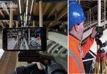
The use of zones of theoretical visibility using precision reality capture can also provide excellent micro-knowledge towards design for screening and mitigation. Current UAV developments include BVLOS – Beyond Visual Line of Sight – studies over infrastructure pipelines, railways and tunnels. In addition, Augmented Reality such as the Epson Moverio has provided consumer-level AR glasses suitable for drone pilots to view both drone and drone’s eye view simultaneously.
While new digital workflows are promised from the technology, from survey to screen with ease, attributes and classifications of ‘reality’ models and interoperability remain difficult. Levels of Detail (LOD) and processing of vegetation alongside classification remain difficult. For example, a drone survey would require a manual classification of a tree to which a computer samples the spectrum and classifies the point cloud to construct an index.
LOD has remained one of the parameters in which a commission is normally undertaken. However, client awareness, as well as the quality of capture along oblique angles, can create wide-ranging results. Alongside the quality of capture, competencies of pilots and extended permissions have created huge variances. However, drone cut-and-fill calculations and earthwork algorithms have proved themselves commercially by allowing site development and progress to be assessed on a daily basis.
Moving from photometric capture packages into Building Information Modelling (BIM) software has also provided challenges: some of these packages requiring a manual tracing of point clouds to create parametric models or additional tools have been required.
As-built models from a drone survey can provide useful information and overlaying the design with a capture site point cloud for context can provide a useful basis to evaluate design intent and identify unrecorded changes made during construction. In the case of Skycatch and Komatsu, drone surveying at all stages of the project using AI. For larger-scale infrastructure projects, light aircraft aerial commissions may be necessary over drones for spatial coverage and this remain expensive.
At policy level, it is also worth noting the Centre for Digital Built Britain has been exploring Gemini Principles for Digital Twins in the United Kingdom, with the Greater London Authority currently seeking a new model with wide implications for planning and social engagement, as well as assessment of London’s green infrastructure and capacity.
Given the longevity of data within a landscape and ecological succession, UAV surveys provide prime opportunities to top-up contentious zones and commissioned sites within wider city-level digital twin models. Web API’s that can host 3D Environments, such as OS Zoom stack, alongside new urban-based GIS software with BIM interoperability also signpost wider city models to which drone data will play a role.
In summary, digital construction, innovation and transformation via new hardware and connected services through drones, AR and BIM will provide exciting new challenges moving forward, though the most difficult issue remains the scope of commission and standard and knowledge of the captured reality, as well as its classification and attributes.
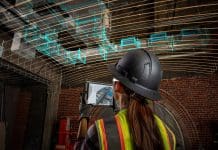
New AR testing and identifiers through survey hint at a future beyond derived meshes of the landscape to pre-classed models direct to BIM tools, then we will be really ‘designing in’. These models, set in the context of a digital twin at city level, highlight the seamless scales of operation that can be achieved.
Senior Lecturer in Design
ImaginationLancaster at Lancaster University
Tel: +44 (0)1524 663 433


