
The synergy of GIS and BIM technologies is revolutionising architectural and infrastructure design, providing designers with invaluable insight and streamlining project workflow
Design for the built environment is a complex process that requires a wealth of contextual information.
To make key urban decisions early in the process, and to deliver building plans that are ready for approval later, designers are turning to Geographical Information Systems (GIS) and BIM.
By combining GIS and BIM data, urban context models can be created, which are
playing an increasingly important role in buildings and infrastructure planning alongside the usual 2D cadastral data and development plans.
GIS in planning
GIS systems are software tools that analyse, display and manage data on a large scale.
In architectural planning, GIS is used to collect and analyse a wide range of geographic information about the urban context of the site in question.
This includes topographical data such as terrain models, infrastructure information and environmental data that define and significantly influence the perimeter of the development.
By integrating this data into the design process, designers can gain a better understanding of the spatial environment and make more informed decisions.
BIM in planning
BIM, the digital methodology centred on a 3D building model, incorporates geometric and semantic data.
In architectural planning, BIM facilitates rapid variant creation, material selection, analyses
(eg energy efficiency assessments) and early-stage conflict identification with building codes.
This significantly improves design efficiency and quality. As a unified design basis, BIM promotes improved communication and collaboration between project stakeholders.
Context models through GIS and BIM
The combination of GIS and BIM enables direct model-based design in context models. This provides a comprehensive view of the proposed building in its urban context from the outset.
By integrating GIS data into the BIM model, architects can not only view the building as such but also understand its impact on the surrounding environment.
For example, factors such as solar radiation, wind patterns and urban infrastructure can be simulated in the BIM model to optimise the sustainability and functionality of the building.
The topography model provides important insights into the height structure of the site. The building cubature of the adjacent development provides critical information on the urban quality of the intervention.
It also improves communication and collaboration between the designers and other project stakeholders such as the client, neighbours and permitting authorities.
Allplan 2024
Almost every AEC project needs to integrate GIS data such as terrains and surrounding
buildings because it’s important for architects, engineers, civil engineers and construction specialists to ensure their designs, buildings or civil structures fit into their surroundings.
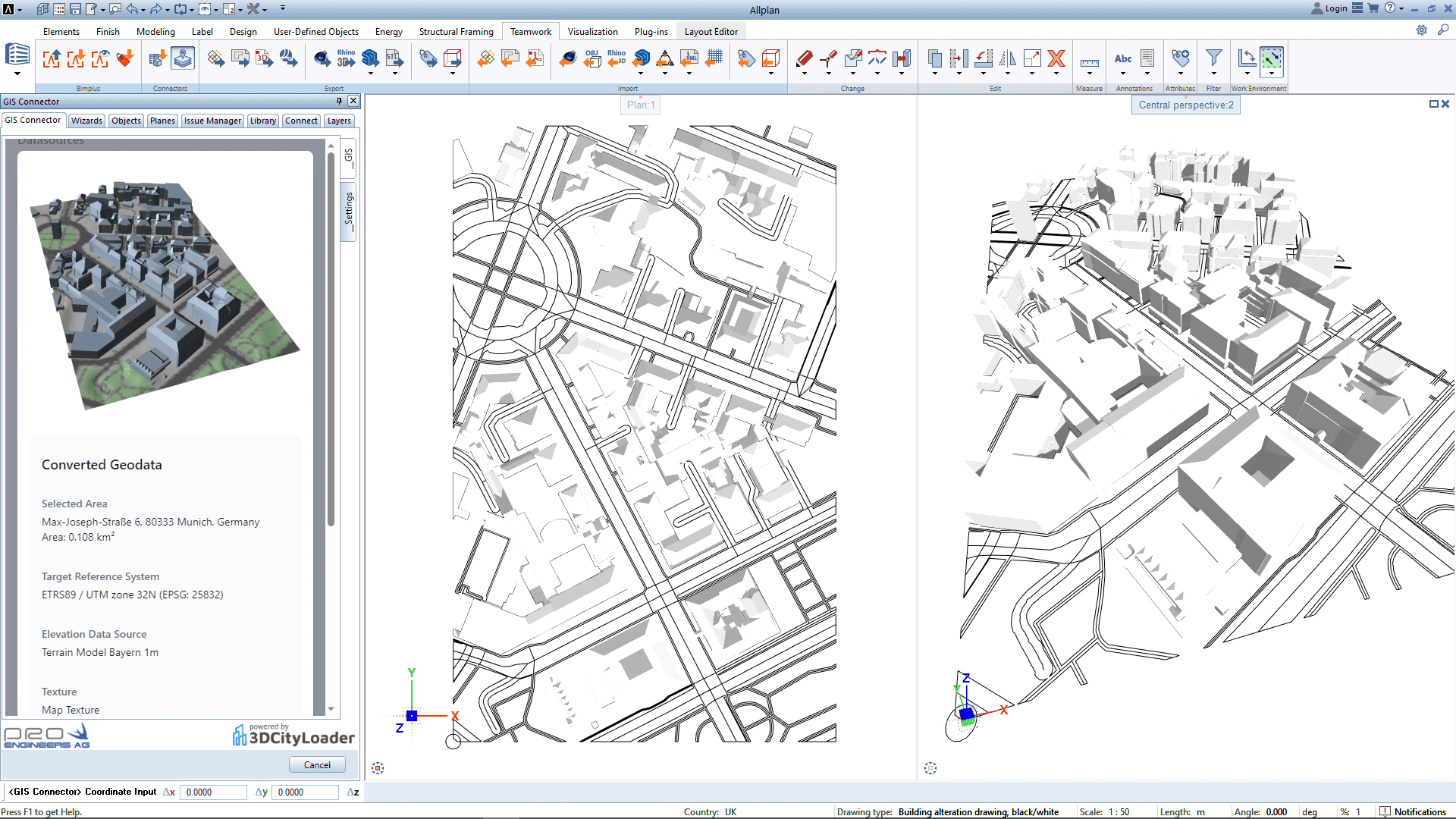
To support this, Allplan 2024 provides new workflows for doing this with its cloudpowered
GIS connector tool that enables the effective and automated extraction of relevant data.
The GIS connector, powered by 3DCityLoader services, provides access to various open GIS platforms and sources, including different European regions, as well as worldwide global surface support.
From a selected area of interest, terrain data, buildings and street contours can be imported to Allplan as different object types to suit various workflows. Importing Proxy DTM terrain is also available, which can be further processed and adapted by the terrain
manager and other functionalities of the Road/Terrain module.
This new feature ensures that real GIS data can be integrated into Allplan accurately, quickly and efficiently, so it can be considered at an earlier stage of the project.
Learn more about GIS integration in Allplan 2024: Features Allplan AEC 2024
ALLPLAN
*Please note: This is a commercial profile.


