
Mobile and stationary technology in one device thanks to Hybrid Reality Capture, powered by GeoSLAM and Flash technology
Simultaneous Localisation and Mapping (SLAM) enabled technology has spent over a decade being developed into a way to collect spatial data in construction and facilities management.
Now, FARO is pushing the latest advancement in mobile scanning devices with the release of the FARO Orbis Mobile Scanner – powered by GeoSLAM’s proprietary SLAM algoritham.
Data insights with Hybrid Reality Capture
Historically, users have had to choose between mobile scanning or stationary scanning.
Both methods share the same goal of maximizing precision and efficiency but came with a trade-off between the high-accuracy data output of a terrestrial laser scanner (TLS) and the speed of mobile scanning.
Stationary scanning: Crafting an accurate depiction of the real world
The fixed position or stationary data acquisition method has been a surveyor’s most accurate tool when it comes to scanning the real world.
Sub-1mm accuracy and clean digital representations revolutionised mapping on a large scale and continue to experience innovation today.
This method of data capture has offered industries like architecture, engineering and construction an avenue for accurately updating job site progress, but at the expense of speed and productivity.
Mobile scanning: The complete solution for versatility
Unlike stationary-based solutions, mobile scanners have the opposite problem. At 10x the speed of a terrestrial laser scanner and the freedom to capture job sites uninterrupted, it feels like the preferred choice.
However, its accuracy levels and data cleanliness don’t match those of stationary scanning systems. Years of development have closed that gap and today mobile scanning solutions offer up to 5mm relative accuracy, which is considered within tolerance for most surveying jobs.
Companies developing mobile or stationary scanning technology have traditionally worked to improve one system or the other, rather than engineer a complete solution – until now.
A flexible solution
FARO Orbis is designed to have all the functionality of a mobile scanner, while also having the high accuracy of a stationary scanner. Powered by Flash technology, Orbis has the means to capture highly accurate data at walking speed, as well as having in-built stationary scanning capacity for mapping areas like complex pipework.
Mobile scanning
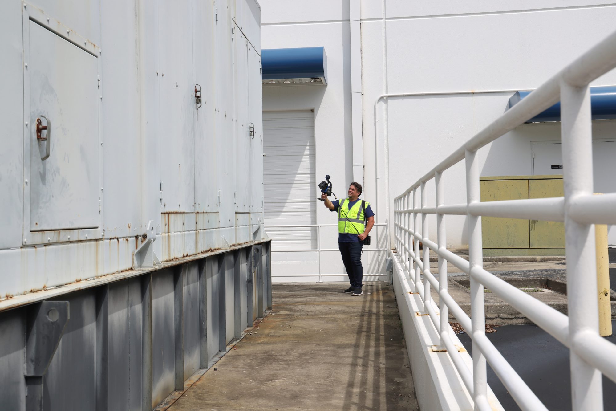
Operating on the move is the core strength of SLAM-enabled scanners like Orbis.
By simply navigating through a job site, users can map extensive areas in minutes, not hours. These real-time scans deliver rapid, valuable data insights and offer adaptability and replicability in scanning.
Stationary scanning capabilities
Orbis benefits from FARO’s expertise in fixed position mapping with integrated stationary scanning capabilities. Powered by Flash technology, users can capture complex details from their scanned environment by simply holding Orbis still on a monopod for 15 seconds, pointing at the relevant area.
This is useful for capturing difficult areas in granular detail and, when compared to other mobile mapping solutions, delivers higher accuracy.
Orbis’s stationary scanning capabilities offer flexibility when it comes to mapping a job
site. It’s easy to switch from dynamic mobile scanning to stationary scanning through the
push of a button, completing as many stationary scans as needed.
It’s the perfect blend of two technologies – but where in the real world is this technology applicable?
Rapid data collection for frequent analysis of AEC projects
The fusion of mobile and stationary scanning technology is set to reshape AEC project
execution through streamlined workflows and real time data integration.
Orbis allows for:
- Progress tracking: Keep up to date with site progress and generate regular documentation for stakeholders.
- Building Information Modelling: Deliver fast and efficient scans of a construction site
regularly and compare point cloud data against the planned CAD model. - Asset management: Efficiency and speed allow for data capture of buildings, delivering a revolutionary way to perform asset management.
- Geospatial: Deliver rapid, safe data collection for geospatial projects, enhancing workflows and allowing for capture of big sites in short time periods.
Mobile and stationary scanning in one device
As the first-to-market hybrid scanner that offers mobile and stationary scanning in one device, Orbis looks to advance 3D reality capture – improving accuracy and efficiency while reducing wasted time and materials for companies across the globe.
Amanda Hidalgo
Office of Corporate Communications
FARO Technologies
Tel: +1 700-161-1036
*Please note: This is a commercial profile.


