Modelling the landscape with BIM can make for better and more cost-effective maintenance. Mike Shilton, chair of the Landscape Institute Digital Practice Group, discusses shaping the green infrastructure of a project in the virtual world
Accurately modelling the real world in a virtual model is a challenge that many in the AEC workspace are battling with on a daily basis. Highly complex geometric 3D models are limited by the availability of product models and the capabilities of hardware, whether serviced locally or by cloud solutions, where pipeline speeds restrict real-time interaction. This has resulted in many BIM for landscape projects concentrating on the data rather than the geometry.
In addition, the rapid exchange of data is hindered by the multitude of file formats and lack of standards that define the data so bespoke exchange formats have to be written to aid this process.
The above makes it very difficult to mimic these objects in a virtual, 3D, data-rich world, and this is when working with building and construction elements that are generally fixed sized, function and perform in a prescribed way and are relatively static.
When we start considering the green construction elements, it is understandable why BIM for landscape has not been a primary concern for most BIM managers. Let’s look at the challenges and what the Landscape Institute in collaboration with other agencies is trying to do to redress this.
There is no doubt that a landscape is complex and rarely comprises simple, flat surfaces. When modelling the external environment, we have to consider undulating topology; moving parts that are ever-changing, seasonally and over time; a complex mosaic of species and vegetation types, all performing in a different way; the intervention of humans through planned maintenance or habitat destruction; and changes in response to local climatic conditions, to name a few.
When we consider growth alone, climatic conditions are a major influence. Different species grow at different rates naturally; they have different ultimate heights and lifespans, and even the same species will perform differently based on a range of conditions.
These include: the size at time of planting; ground preparation; quality and handling of the stock prior to delivery and storage on site; soil quality and type; degree of soil compaction; soil amelioration; fertilisation; underlying geology; soil pH; irrigation; drainage; and whether the site has a north- or south-facing aspect. It will also include the location of the site, as the height above sea level, local temperature and climate impact how fast or slow it will establish and grow.
Added to this, the same species can be influenced significantly by maintenance as often it can be used as a feature specimen, part of a planting mix or within a hedge. So when a landscape architect is asked to model the planting accurately, you can see how difficult this can be!
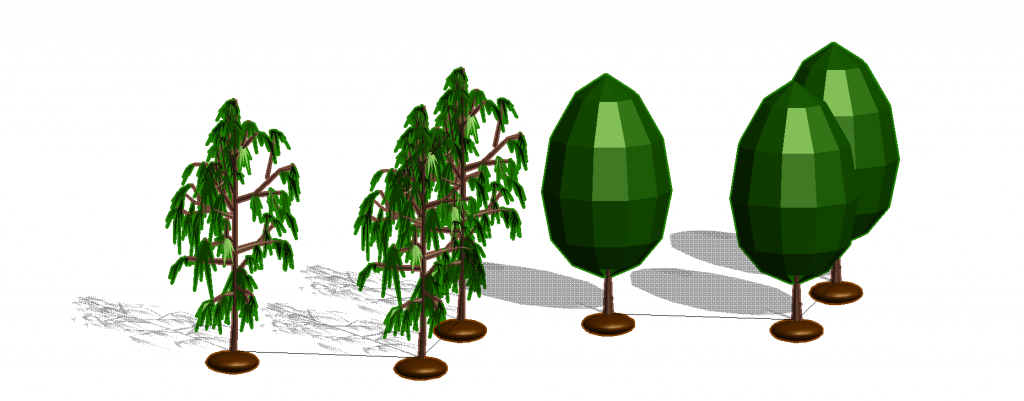
To model a tree or shrub and make it look realistic means you have to consider not only the roots and stem but every branch and leaf, which results in a huge model. Given a planting plan can contain several thousand plants, modelling trees to this level of detail is not practical. Many applications offer the ability to represent trees using images but typically the palette of images available is limited or costly to purchase, especially when a wide range of species need to be represented. We need to understand why we are modelling objects and the purpose of doing this in a BIM environment.
The reason we are creating 3D BIM models is to answer key questions about the site and enable project coordination. This often requires clash detection between tree roots and below-ground features, such as services.
But trees also have an impact above ground. Plants not only contribute visually and aesthetically but also have a significant impact on site conditions, such as providing winter shelter and summer shade, both affecting the heat loss and gain on site and the lower floors of buildings.
Do we actually need to see every element of a tree to make these assessments or is it more practical to represent a tree using a volume-based model, where its geometry is represented by simple 3D primitives, such as spheres and columns?
When considering other built elements, we don’t need to model every nut and bolt to make decisions about an object. Similarly, is it necessary to model every tree to the finest detail?
When vegetation interacts with other elements in a project, such as their location in relation to a building’s ingress, egress and service points or its lower level windows, it may be appropriate to only model these in 3D within the first few metres of the building or structure.
Again, unless the planting’s purpose is to screen views in and out of the site, do we need complex models around the perimeter? I would argue that, unless it answers a question, any 3D is only visualisation and, if that is its only purpose, do we really wish to slow down the BIM model unnecessarily?
The problem we face at the moment is that many people want a single model that meets the requirements of the BIM project, with the ability to create high quality, realistic visualisations. While this would be utopia, in reality these have two separate functions and should be managed as such.
A visualisation is most often required for sales and marketing purposes and is better handled in graphics packages, while the BIM model is necessary to help with project delivery and maintenance.
A contractor does not need to see a wonderfully rendered tree that moves in the wind and changes with the seasons; the site operatives simply need to know what plant is required, where it is to be planted and how to maintain it thereafter.
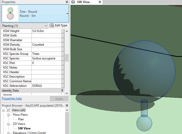
There is a lot of work going on within the industry to define the Level of (graphical) Detail (LOD) and Level of Information (LOI) required to describe and represent an object at each stage of a project, including maintenance. The Landscape Institute is currently working to define this for landscape objects.
To answer these questions, the data associated with the object is currently more important than the geometry and many project managers are now focused on specifying simple 3D representations or 2D placeholders for the data rather than creating complex 3D models.
With the Internet of Things, this data is going to be more useful as it will link the virtual model with real-world feature and allow us to deliver more focused, cost-effective maintenance that will produce better performing landscapes, which is the main benefit of implementing BIM for landscape.
Mike Shilton
Product Director
Keysoft Solutions
Tel: +44 (0)3451 303040
Twitter: @ksoftlandscape
LinkedIn: Key Traffic Systems


Evolution: Advancing digital twins in the AEC/O industry")


