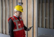
There is no one-size-fits-all approach to retrofit, but knocking down and starting again isn’t an option. BIM is now proving its value in repurposing existing buildings through the use of geospatial data, says Diarmuid Murphy, director of property at Murphy Geospatial
The pressure is on to retrofit the UK’s built environment so it’s more environmentally friendly and can stand the test of time. Planners want developers to reuse existing buildings rather than develop new schemes and are implementing retrofit first policies as a result – as seen in the latest city plan for London. But with such diverse buildings and solutions available, how do we do this without major disruption and sky-high bills?
Why the pressure is on to retrofit
Many businesses are now obligated to report carbon emissions, which has triggered a hunt for offices and facilities with green credentials. It isn’t surprising that, according to a 2023 Sustainability Report from RICS, occupier and investor demand for green buildings
has risen.
Given buildings are the second highest-emitting sector, the UK government is also setting legislation that raises the required environmental performance of buildings to support their target to reach net zero by 2050. Corresponding policies are changing all the time: the UK government lifted the cap on solar arrays on business roofs in November 2023, for example.
The UK and Ireland’s built environment, although a big contributor to carbon emissions, is also treasured by many. We are world famous for our historic buildings and the stories they tell, with just under 500,000 listed buildings in the UK. Of the approximately 30m buildings in the UK, 5.9m buildings (21%) were built before 1919, and a further 4.3m (15%) before 1944.
Unfortunately, historic buildings typically have low energy performance due to limited insulation, single glazing and poor air tightness. The structural make-up of these buildings also vary hugely as different building methods were used across the decades. Many lack original design plans that would inform retrofits, and there is often limited data available on their current structure. This poses a real challenge to an industry that is trying to deliver big changes at pace.
Retrofitting buildings so they are energy efficient and swapping out old energy generation systems for new decarbonised setups is no mean feat. One of the biggest barriers to making the UK’s built environment more sustainable identified by RICS is initial cost outlay – with no “one-size-fits-all” retrofit solution, it’s easy to see why.
The cost associated with knocking everything down and rebuilding means starting again isn’t an option. We also need to avoid losing the enormous amounts of embodied carbon in existing buildings and the emissions associated with the mining and fabrication of raw materials needed for new developments.
So how can the industry retrofit without it being very costly and extremely disruptive?
Simulating retrofit before a spade hits the ground
Building Information Modelling has been widely used in the construction industry for new assets but it’s now coming into its own and demonstrating is value when assessing the process of retrofitting older structures for energy efficiency, preservation and repurposing.
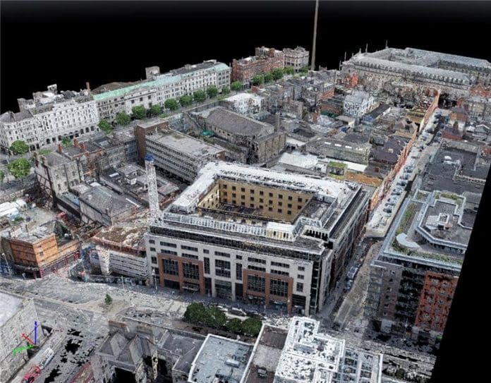
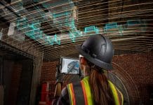
We use advanced scanning technologies at Murphy Geospatial, such as 3D laser scanning or LiDAR, to accurately capture the existing conditions of older buildings via digital geospatial data. This data can then be integrated into a BIM environment to provide a comprehensive baseline that can be used to simulate retrofit projects, which can then be tested out in the model, rather than on-site.
The precise understanding of existing conditions in a digital model means any problems associated with retrofit options – whether that’s introducing air source heat pumps, extra insulation or PV panels – can be spotted and problem solved in the digital model, avoiding both disruption and spiralling costs.
One such project we’re working on is Dublin Central, with our client, Hammerson, where developers want to be sensitive to local heritage. They are taking a historic building and using innovative methods to make it a work as a modern space.
BIM can be used in a variety of other ways to inform retrofit designs, including carrying out thermal modelling and simulation, allowing designers and engineers to find out where and how energy efficiency measures will provide the best results. BIM can also facilitate the buy-in often needed from the huge range of stakeholders involved in big commercial projects as a shared digital model can be accessed by anyone with the login, at any time.
Once an asset owner has invested in BIM, it isn’t just a tool to reduce building carbon emissions, either; it can be used for space optimisation, maintenance planning and improving disaster resilience in the future.
Accurate geospatial measurements are crucial
Many in the industry believe that accurately measuring carbon emissions from buildings will be expected in the years to come, but carbon emissions reporting isn’t the only big drive for accurate data in the construction industry because bad data – environmental or otherwise – comes with a cost.
According to Autodesk’s research, in Europe, 40% of the average organisation’s data is bad, leading to poor decision making 41% of the time, and in the UK, 32% of data used by construction companies is bad, leading to poor decision making 31% of the time.
Data inaccuracy comes from disconnected communication channels where site data is shared, or teams use outdated information that hasn’t been validated. Geospatial data overseen in a geospatial management plan offers the opportunity to take live projects from build to digital reality, filling the gaps in lost data and streamlining data sharing among teams so everyone has one version of the truth.
Accurate geospatial measurements are crucial during construction as it provides the framework for digital delivery, multiple stakeholder collaboration and is the cornerstone of automation.
Investing in the future with cost-effective retrofit designs
Retrofitting the UK’s built environment is a huge job but understanding the precise layout and structure of existing buildings, and simulating retrofit options in a digital environment before any changes are made on site, will support the industry to develop informed and cost-effective retrofit first designs.
Investments made into capturing a building’s geospatial data digitally will continue to bear fruit in the future, too. The geospatial data fed into BIM acts as the launch pad for the next phase of design, construction, refurbishment and facilities management – the digital twin. A digital twin ties the digital representation of the building together with the physical reality of how the building is used, and how this can be improved.
With the right tools and skillsets, “retrofit first” is far more achievable than it might initially look. Not only that but any investments made in gathering the right data will hold significant value well into the future.
The way buildings are used, and our expectations of our environment, will continue to change, along with our climate and legislation. Asset owners and managers with the data that allows them to simulate any changes they want to make in response will always have a head start. With the right data, “retrofit first” can become a reality.
Diarmuid Murphy
Director of property
Murphy Geospatial
Tel: +44 (0)203 598 3775


