AtkinsRéalis has created a new solution to streamline the processes involved in biodiversity net gain management and meet the new legislation in England
Determining biodiversity net gain (BNG) has become more complex with the new legislation, which now needs to be run every time a design scheme is altered.
Organisations also need to be able to prove that the data being used is the most current version available.
Global design, engineering and project management organisation AtkinsRéalis was already committed to sustainable development but needed a way of meeting the Environment Act 2021.
This demands that all new construction projects from February 2024 deliver at least 110% of the biodiversity value found on a site before its development.
Deciphering a complex working environment
On any large infrastructure project there are numerous disciplines, including design, engineering, construction, geotechnical and ecology, all working to limit the negative impact on the environment and understand the central design.
Working on similar BNG questions nuanced to their field, these disciplines also need to be able to understand each other’s domain.
With multiple inputs and outputs, a highly complex working environment is soon established and maintaining it can get very expensive without any central spatial system or automation.
The risk of problems from out-of-sync versioning could be potentially disastrous for a project, including delays in construction and costly reworks.
To ensure all parties remain aligned, a single source of truth devoid of any human error is critical. Having this as a repeatable, iterative, accurate process, enshrined in a concrete GIS element, is absolutely vital – and this is what AtkinsRéalis created.
Streamlined digital workflows
The new solution streamlines the processes involved in planning, monitoring and reporting on the amount of BNG for each rail, road, energy or other project.
The geospatial approach has created new digital workflows involving interactive map dashboards and web maps for better data sharing and mobile apps for faster data collection in the field.
The result is an incredibly accurate, efficient and cost-effective method of managing a project’s impact on the landscape, ensuring environmental sustainability and meeting the new legislation.
Client projects where AtkinsRéalis has used the new solution include both rail and road, as well as utilities and masterplanning.
At the heart of the BNG solution lies the AtkinsRéalis Spatial Common Data Environment (SpatialCDE), which means solid data management is already in place and accelerates any analysis performed upon it.
The SpatialCDE is a fully custom tech-stack, combining open source with FME, Esri UK’s ArcGIS Portal – and Microsoft Azure to create a resilient data management and visualisation toolbox.
Using ArcGIS Python libraries, the SpatialCDE can build custom analytical applications quickly, so users can view or analyse data in 2D or 3D to answer their specific queries.
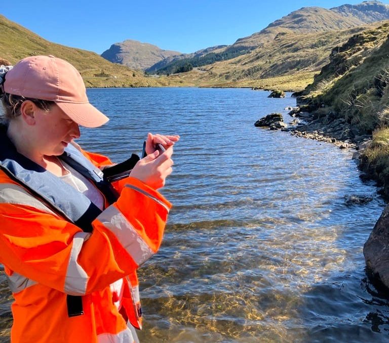
Environmental Impact Assessments (EIAs) are conducted using ArcGIS Field Maps on mobile devices. Ecologists use map-driven mobile forms to capture different assets and observations to complete their work efficiently and accurately.
Data is then automatically uploaded to the SpatialCDE. The whole platform is aligned with ISO 19650, the international standard that sets data management guidance and is BIM Level 2 compliant.
When BNG is being examined, the SpatialCDE looks at the type and volume of habitats that are due to be impacted. Replacements or mitigations are then calculated. This workflow takes seconds instead of days or weeks, compared to a traditional manual paper-based method.
Benefits to date
Delivering more efficient data collection and management saves each project £300,000 per year. Time saved comes from:
- Less time spent looking for and collating necessary data.
- Ecologists spend less time collecting data in the field.
- Less physical meetings to discuss the latest version
of the design. - No additional processing or inputting of the data.
- No paper drawings or maps.
Quickly developed custom tools deliver an additional £160,000 cost savings per year, per project. This comes from applications created to answer specific biodiversity questions taking only hours to develop, not days.
In one project, a 1,000% potential increase in BNG is projected, thanks to a comprehensive identification of opportunities using the new system:
- Following a systematic search of the study area soft estate, four areas of opportunity were selected for the feasibility study stage.
- Proposed habitat interventions included the creation of mixed scrub habitat and neutral grassland enhancement.
- Once interventions have been trialled, the most successful can be replicated on similar sites across the region.
Harriet McQuade
Geospatial business lead
AtkinsRéalis
Tel: +44 (0)20 3214 8812


