
The Arcadis Kidsgrove Station project for Network Rail created a completely new digital method of understanding and managing risks from substantial mining legacies
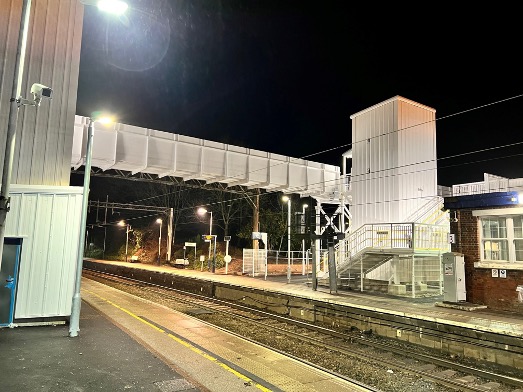
As a result, a new footbridge with lifts could be built providing step-free access to all platforms without any significant operational impact on active rail services
Arcadis was commissioned by Network Rail and Galliford Try to undertake design services for Kidsgrove Station as part of Network Rail’s Access for All scheme.
At the time, the station provided no step-free access to three out of four platforms. A new footbridge with lifts was proposed to provide improved access.
The station is on a section of Britain’s busiest mainline railway, the West Coast Mainline Stoke to Manchester section and a busy junction with a branch to Crewe, which had to remain operational throughout the works.
Managing the risk of mining legacies
The key technical challenge was to undertake all the work while managing risks posed by a substantial mining legacy. This comprised several workings at various levels, steeply dipping seams and the presence of shafts in adjacent properties.
Furthermore, the mining records held for the area were incomplete. Potential impact on the operational railway, groundwater and gas regimes and the station and surrounding buildings were considered. Further investigation and grouting of the mine workings were required before construction could begin.
Digital collaboration
To ensure the desired outcomes of the project, it was imperative that the project adopted a new, digitally collaborative methodology to monitor progress on site and visualise multiple information sources in one location, accessible to the project team, client and other stakeholders.
The challenge was how to combine multiple types of very different data, including BIM, laser scanning and sonar surveys, instrumentation and measuring (IoT) and historic mine records. Traditional methods of managing 3D data of this nature were not suitable.
New approach
A new digital collaborative methodology led to a 3D mine model being created. By transforming data from OpenGround Cloud to Esri’s ArcGIS Pro, using FME and combining it with historic data, grouting records, the BIM design and other contextual data, the project’s digital twin was brought to life.
The model was shared via an Esri GIS web application, providing the project team with a data-rich environment, enabling improved quality assurance, customer service, decision making and stakeholder engagement.
Benefits
Using GIS from Esri UK allowed the visualisation of numerous information sources in one location and enabled multiple stakeholders to make informed and timely decisions to deliver the works on time, to quality and with excellent health and safety.
The 3D Mine Model was the core information system driving the entire project, embedded deeply into project workflows and used in survey planning, design and stakeholder meetings.
The benefits have been significant, centred around a streamlined, successful delivery of safe and practicable remediation of the mine workings, under the West Coast Mainline. This meant the new footbridge and lifts could be built, providing step-free access to all platforms at Kidsgrove Station.
Examples of improved performance, safety and efficiencies included:
- Customer-focused project delivery: Successful delivery of safe and practicable remediation of the mine working under the West Coast Mainline.
- Improved H&S and risk reduction: Zero incidents and satisfied the client’s requirement to address legacy mining risk.
- Improved efficiency savings of around £1m: The resulting potential saving from improved site work efficiency, avoided abortive works and maintaining operational status, therefore no significant rail disruption.
The outcome of this project was that it created a new way of working to support the customer and the industry as a whole – it’s a repeatable solution. Ultimately, the new approach gave Network Rail the confidence that mining legacy risk could be effectively managed without significant operational impacts while the new footbridge and lifts were constructed.
Network Rail identified the solution as an improved method, supporting their proactive approach to mining legacy and avoidance of operational impact. It enabled the company to capture the work done in a 3D Esri ArcGIS feature format, which is how it would like to host its mining information going forward.
Gideon Simons

Associate technical director, GIS & geospatial
Arcadis Consulting UK
Tel: +44 (0)20 7812 2000


