
Lincoln is using a purpose-built online heritage database to help planners, developers and property owners understand the city’s historic environment while protecting its rich heritage. Kieron Manning of the City of Lincoln Council and Annabel Enriquez of the Getty Conservation Institute discuss the project’s development
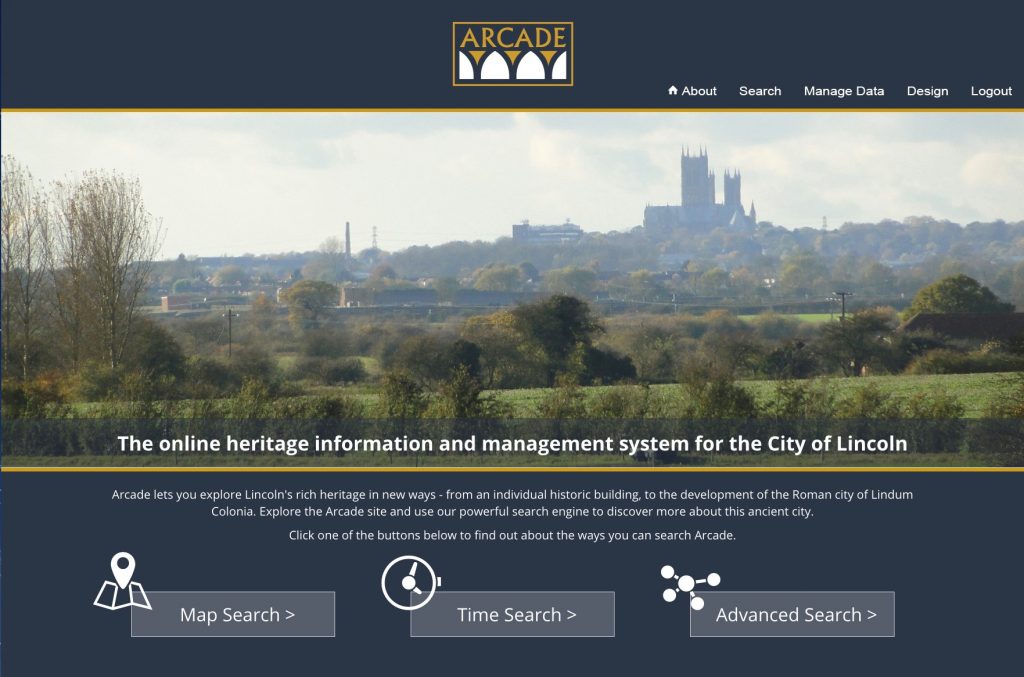
In May 2018, the City of Lincoln Council, in partnership with the Getty Conservation Institute (GCI), launched ARCADE (Fig 1), a dynamic and powerful web-based system to serve as Lincoln’s official historic environment record (HER) with ready access to information about the city’s rich cultural heritage, including historic buildings and structures and archaeological sites. ARCADE is now available for use by planners, developers, property owners and the general public to better understand Lincoln’s historic environment and as a tool to guide development activities while protecting Lincoln’s heritage.
ARCADE provides City of Lincoln Council with a purpose-built online heritage database. It sits within the council’s planning department and is used to help inform planning decisions in Lincoln. With around 2,000 years of settlement underlying the modern city, almost any new development in the city centre has the potential to unearth archaeological material.
Similarly, as a city since the 11th century, Lincoln has many historic buildings, with almost a quarter of listed buildings designated as Grade I. This means that both developers and planners need to have access to heritage evidence to inform applications and decisions (Fig 2).
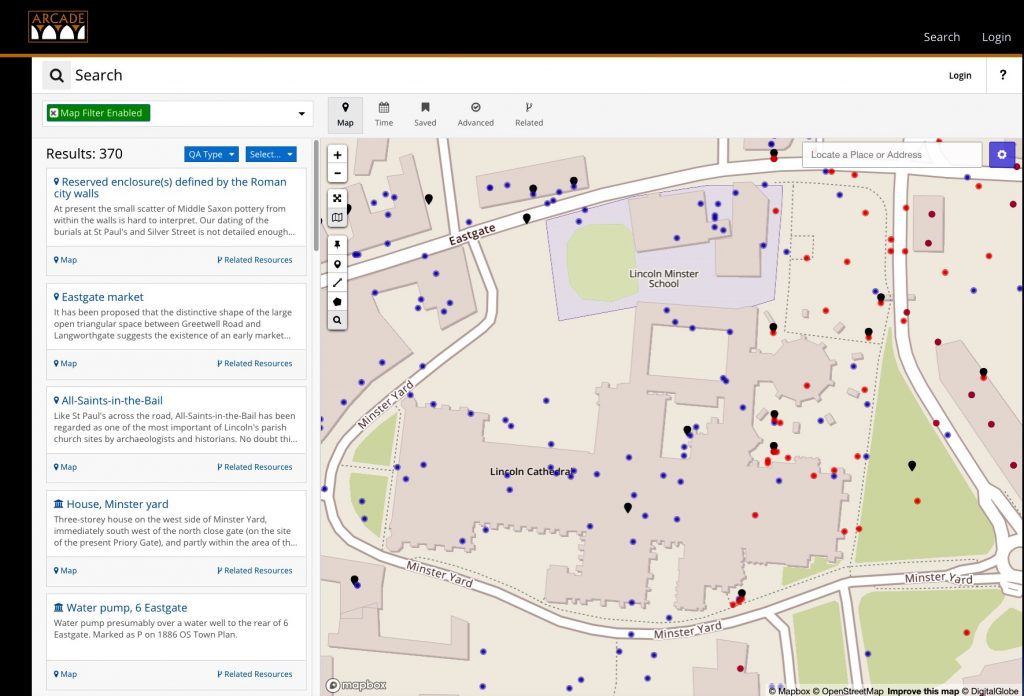
ARCADE makes this information available through an easy to use interface with the ability to search both spatially and through a Google-style search bar.
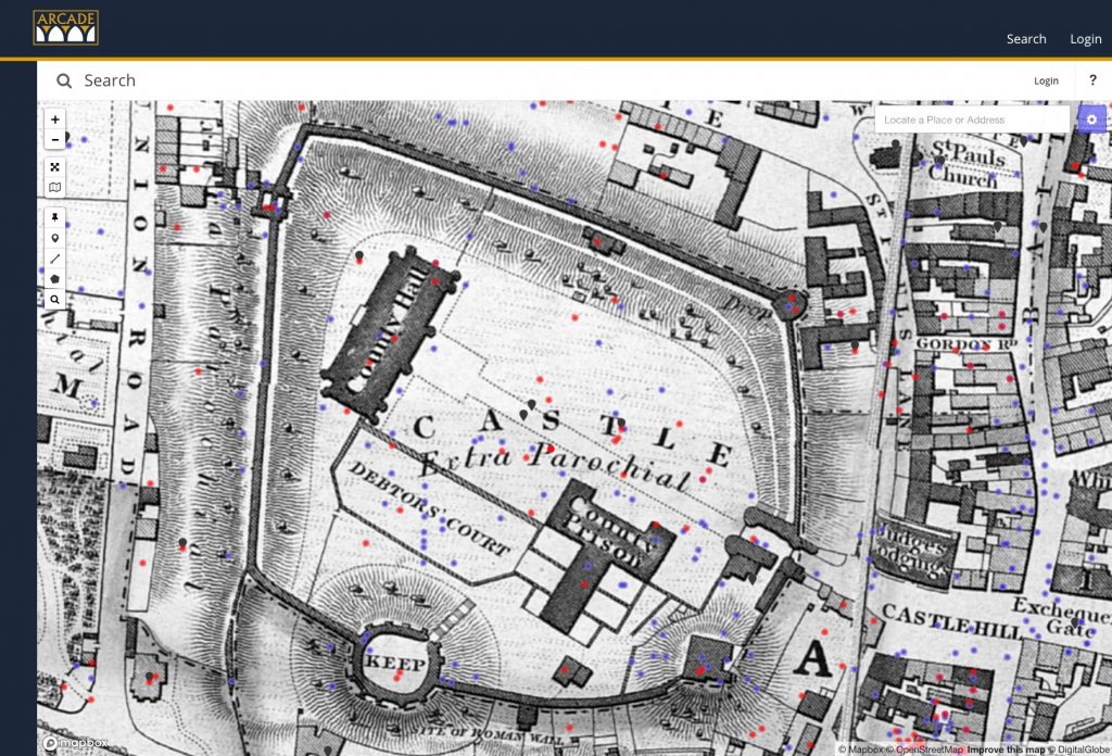
Results are displayed against a variety of map data, including historic Ordnance Survey maps dating from 1889 onwards (Fig 3). This makes ARCADE a useful tool for a range of professional advisers outside the heritage profession, including specialists in land contamination.
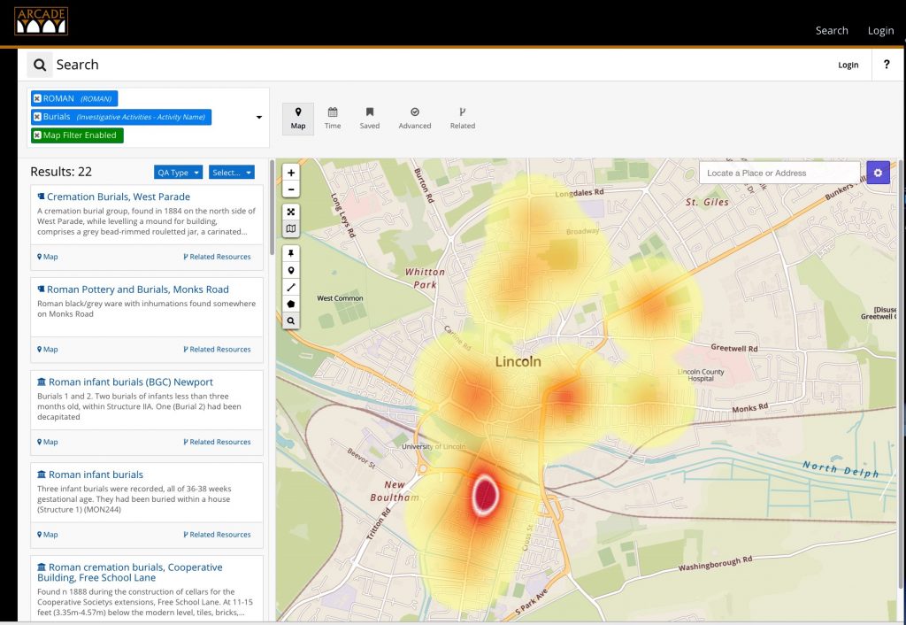
There are also in-built analytical tools for researchers, such as the dynamic heatmap of search results. This gives users an at-a-glance view of the distribution of search results which can be key to establishing potential impact on heritage (Fig 4).
As a tool in the planning process, ARCADE is already being used by developers and planners at the early stages of project planning to establish risk of impact on heritage and plan for contingencies, and to understand the context of development proposals.
ARCADE provides a new way of accessing the detailed characterisation information from the Lincoln Townscape Assessment, which means that new buildings can be designed in such a way as to respond to the existing aesthetic, including materials, scale and design.
For archaeological heritage, the Lincoln Archaeological Resource Assessment can provide an early understanding of the likely archaeological potential of a site.
Both of these tools can be used alongside up-to-date information about specific heritage assets, allowing developers to maximise the opportunities presented by the city’s heritage and minimise risk to budgets and timescales from unforeseen obstacles.
The ability to incorporate heritage information into the development process is also enabling a strategic approach to heritage-led regeneration to be adopted in the development management environment. In this way, heritage can play a full part in the overall place-shaping agenda.
ARCADE is powered by Arches, an open source cultural heritage data management platform that was developed by the GCI and World Monuments Fund as a tool to help cultural heritage organisations around the world better inventory and manage their built cultural heritage.
The mission of the GCI, a non-profit philanthropic institution based in Los Angeles, is to advance heritage conservation practice and to support heritage professionals internationally to preserve cultural heritage. Because Arches is open source software, it is free for organisations to download and customise to serve their specific needs. To date, myriad organisations have used the software to inventory their cultural heritage, ranging from national-scale inventories in Asia and the Caribbean, county- and city-wide implementations in the United States and UK, and an Oxford University-based project to record endangered archaeological sites across the Middle East and North Africa.
In the United States, the City of Los Angeles launched the Arches-powered HistoricPlacesLA, the Los Angeles Historic Resources Inventory, in February 2015, which provides online access to a complete inventory of surveyed and designated historic resources throughout the city’s more than 880,000 property parcels. HistoricPlacesLA fully integrates historic resource information into the city’s planning processes to help guide policy and decision-making, including assisting planners with their daily work, such as project review and environmental law compliance. Developers and property owners are also able to see how they might be affected by historic designation, as well as identify historic buildings for potential investment.
In the UK, Historic England has adopted Arches as a core information technology for use throughout the organisation and will use it for the national maritime heritage inventory of nearly 50,000 sites, as well as to manage England’s official controlled terminology for the nation’s heritage sector, which is used by more than 80 local heritage authorities.
In addition, HE and the GCI have partnered to create an Arches-powered historic environment record for Greater London to be launched in 2019. Through implementing Arches for Greater London, the GCI will create a new Arches module supporting casework and consultations workflows to track the status and outcomes of project reviews for environmental impact compliance. Because Arches is open source, other organisations, including heritage authorities across the UK, are able to freely download and build upon the work done to customise Arches for Lincoln and Greater London.
Kieron Manning
Planning Manager
City of Lincoln Council
Twitter: @lincolncouncil
Annabel Lee Enriquez
Associate Project Specialist
The Getty Conservation Institute
Twitter: @GCIConservation


