Geospatial startup partners with Esri UK to improve urban planning for community facilities and spaces
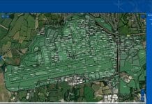
Yeme Tech has created a Community Data Platform (CDP) to help planners and developers identify social infrastructure, facilities, and community spaces which are missing from British towns and cities.
The platform measures community resources such as schools, shops, green space, libraries and cultural assets, as well as local stakeholders, local events and the activities of local groups.
ESG Social Reporting Index
The ESG Social Reporting Index helps developers, investors and others to target and evidence social uplift around their assets or development sites.
Founder and CEO Amir Hussain believes the CDP will create happier and healthier neighbourhoods.
Amir said: “Society has changed beyond all recognition over the past 30 years.
“The failure of places to keep pace with change is understandable but means towns and cities across the UK, like those across the world, have lost track of the needs and wants of local people.
“This leads to places losing their sense of identity while loneliness, exclusion and community fragmentation are having profound impacts on health and wellbeing.
“The death of retail and the High Street offers councils and developers a bold opportunity to reinvent their neighbourhoods by strengthening existing social and community assets and strengthening relationships with local stakeholders.
“It can be very complex and time-consuming to regenerate our towns and cities to adapt to meet the current and future needs and wants of their citizens.
“What our Community Data Platform does is provide granular local detail in real-time to strip away the complexity and enable planners and developers to work with local communities to deliver successful urban planning which provides the facilities and social infrastructure that people need and want.”
Laura Dean, Esri Partner Network Manager, said: “Esri UK is delighted that Yeme Tech has joined our Esri Partner Network.
“Making use of our suite of developer tools, ArcGIS Developers, the team has managed to represent community data in a clear and engaging manner, allowing users to achieve valuable new insights.”


